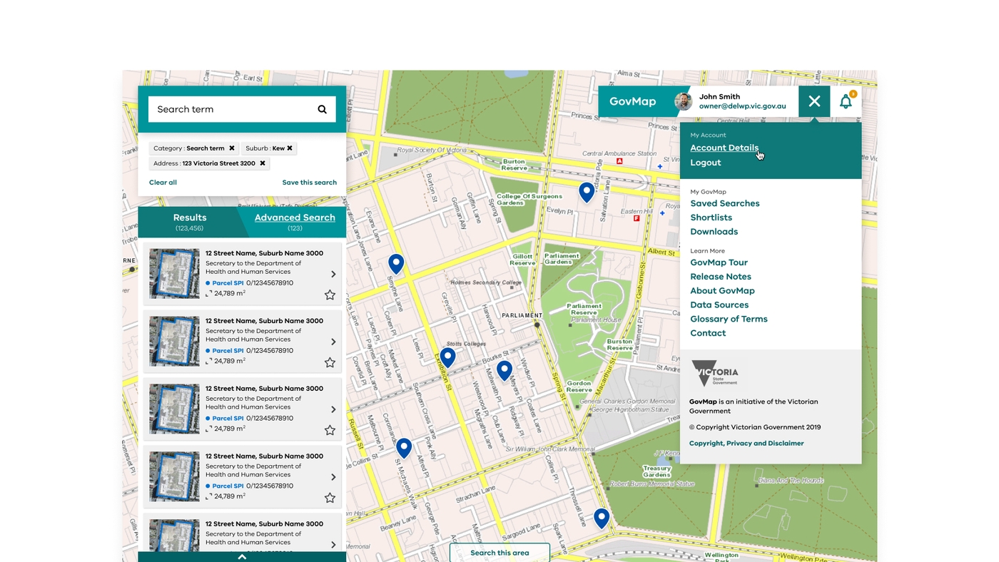
The Victorian Government is responsible for 40% of Victoria’s land, with more than 100 different agencies involved in managing it.
The current process of finding out what land the government owns, what it's being used for, and how an agency might obtain it is laborious and requires specialist expertise. The Victorian Government’s Department of Environment, Land, Water and Planning (DELWP) engaged Portable to bring user-experience design expertise to a new online map tool being developed that would make it much easier for stakeholders, expert and non-expert alike, to find information about government-owned land.
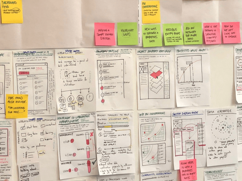
To do this, Portable drew from its user-centred toolkit, processes and experience. We set out to design ways to make the plethora of information more understandable and usable to non-expert users.
- Portable conducted user research, including co-design workshops, with key user groups to design user personas and journey maps for regular users of the system, such as asset managers, to irregular users, like the project officers in state government that might be looking for land to use.
- With DELWP’s software development agency, Portable’s designers worked in agile sprint cycles to bring the prototype to life, tackling the major challenge of how to logically present the many different dimensions and layers by which it’s possible to search and filter land.
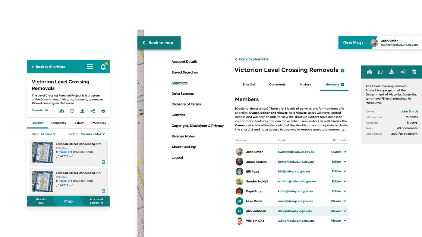
- Our approach to the UX design took a 'progressive disclosure' approach – the interface is simple at first, allowing for basic tasks by non-specialist users, but additional options and features appear when a user requires more information.
The expertise used in this project included:
- UX/UI design
- Co-design
- Agile service delivery
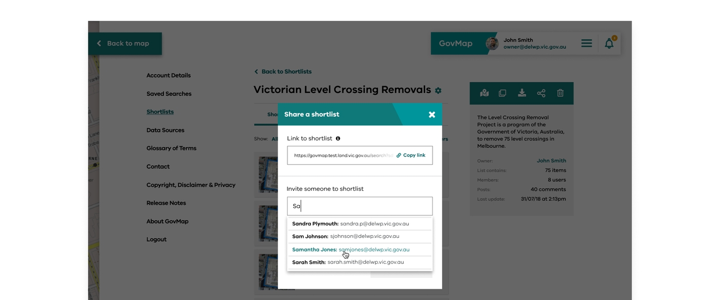
With GovMap designed to be as easy to use as Google Maps for government land, the reliance on specialists has reduced.
Further development of the product is enhancing search options and collaboration with colleagues, as well as augmenting current GovMap data with new datasets, and we are continuing to collaborate with DELWP and Victorian Government users to improve the experience.
Outcomes and benefits:
- GovMap now provides first-ever access to multiple Government land data points in a way that is accessible and transparent
- Over 1000 government users have registered to date, using GovMap for an average of 10 to 15 sessions per week.
- It reduces the time to complete land searches and enables faster decision making
- Communities now face lower barriers to obtaining assets they care about like schools, public art, and green space
- New features are being added all the time, with the ability to search on a variety of criteria — such as suburb, postcode, landholder, Crown/freehold, size, planning zones, and more — as well as collaboration tools that allow users to share individual properties, lists and saved searches with colleagues
- The Australian Information Industry Association (AIIA) named GovMap winner of Data Insight of the Year at the 2019 Victorian iAwards — congratulations to our colleagues at DELWP and Dialog IT!
Download our report on innovation in government
